Several key events opened the door for pioneer settlement and Michigan Fever. The 1825 completion of the Erie Canal opened a new and easy route to the territory via the Great Lakes and Detroit, and by 1833, federal Indian policies had removed most Native Americans to the west of the Mississippi, which paved the way for government land surveys and, thus, for increased agricultural settlement. It was these government surveys that divided the land into sections and townships, designations that are still applied, and greatly influenced the size and location of early farms. However, one of the most important of these were the many internal improvements made to the state's infrastructure by territorial Governor Lewis Cass.
Michigan's Territorial Governor Cass (below) strongly encouraged legislation for improved roads and the support of education through the use of public lands.
Governor Cass waxed enthusiastic at the
prospect of development opened by the Erie Canal and saw in
it the inevitability of statehood. His treaties acquiring lands, the beginning of
public-land sales at Detroit in 1818, the start of steam navigation on the Lakes, and the
actual opening of the Canal in 1825, all began a new era for Michigan. Between 1830 and
1837 the population soared from 31,000 to 87,000.
The southern third of the state was settled first. It was the first
portion surveyed and included some of the best farmland in the state. In addition, the
Chicago Road, the Monroe Pike, and other transportation arteries provided easy access from
principal entry points such as Detroit and Chicago.
Source: Michigan History Magazine
A majority of the early pioneers were New Englanders. These settlers found that the small
prairies and oak openings of southern Michigan were well adapted for wheat, and wheat and
wool eventually became the state’s principal cash agricultural products. People
arrived in such numbers that between 1820 and 1834, the population increased tenfold. By
the time Michigan was about to become a state, Michigan Territory had become the most
popular destination of people moving west.
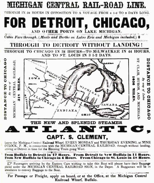
The flood of home-seekers was swelled by the "internal
improvements" frenzy that swept over the Nation, and supported by Michigan's
Governor Cass. Most of the early roads in the state were in very poor condition, and
hence were in great need of "improvement" if the early economy of the state was
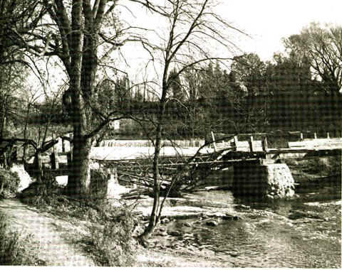
going to advance. For example, check out the early bridges shown below:
Source: Michigan History Magazine
The lack of bridges made even the smallest stream a nuisance. After reaching Montcalm County, it took one family a month of hard labor to forge a three-mile road to the land they had selected! Here are the details: German immigrant Charles Deaner arrived in Michigan in 1860 after a decade in New York City. He purchased eighty acres in Richland Township and got as far as Ionia county before poor roads caused the teamsters carrying the family’s belongings to unload them and desert the new immigrants. After hacking a road through the wilderness, the Deaners reached their land and built a cabin. However, Deaner’s father-in-law carelessly discarded a match, and soon the cabin and all the Deaners’ possessions were destroyed. Rain and cold plagued the family during the three weeks it took to erect a new cabin. The family did not even own a plow and used an axe to break up the ground to plant corn and potatoes. Surprisingly, Deaner remained in Montcalm County, and county historian Dasef noted that he later became "entirely successful."
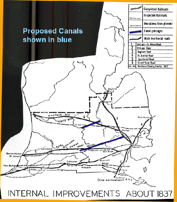
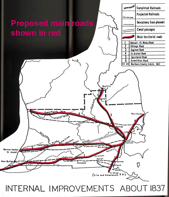
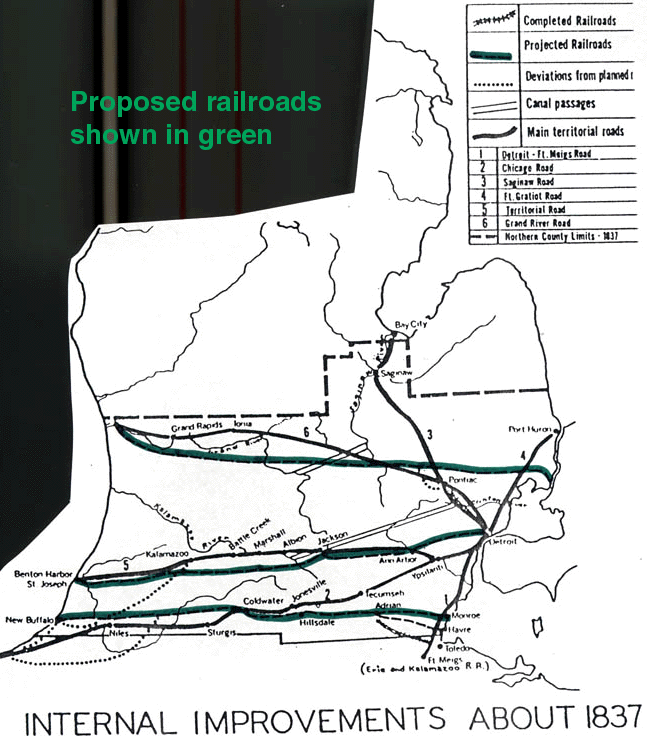
In the 1820's Michigan acquired its first great highway, built from Ohio to Detroit with
the aid of Federal funds. Petitions for aid in building roads, canals, harbors, and
railroads poured upon the State’s delegation in Congress. The desire for these
"internal improvements" was so great that many a scheme was concocted but never
carried out. For example, the map below shows where canals were proposed.
Source: Michigan History Magazine
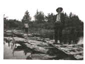
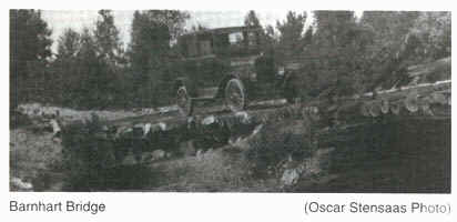
The two images below show one of the proposed canals being built. Neither of the
proposed canals actually were built to completion.
Source: Michigan History Magazine
Source: Michigan History Magazine
Source: Michigan History Magazine
Parts of this page have been taken or modified from Michigan History magazine.
This material has been
compiled for educational use only, and may not be reproduced without
permission. One copy may be printed for personal use. Please contact
Randall Schaetzl (soils@msu.edu)
for more information or permissions.