 |
 |
 |
|

| [ 1, 2, 3, 4] |
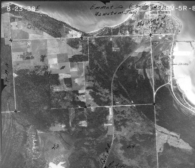
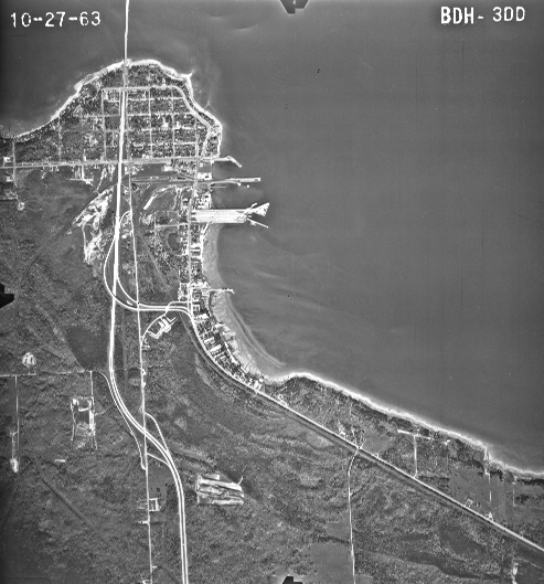
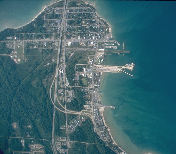
| The Forestry Service uses aerial photography to determine the distribution of tree species, detect areas infected with disease and interpret land use and land cover change over time.
As Michigan was colonized, the distribution of the white pine changed. The area highlighted below, which is the natural habitat for the white pine, (area determined through interpretation of photographs and distribution map of pines (Spatial Distribution of Pines) demonstrates this change over time (see the economic section to learn more about the logging and profiting of the white pine). In 1938, the white pine was thriving and abundant in Cheyboygan County. In 1963, the effect of logging, development of housing and the construction of roads began to become more evident. In 1992, the decrease in the white pine distribution is now even greater. |
|
|
|
|
|
|