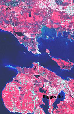
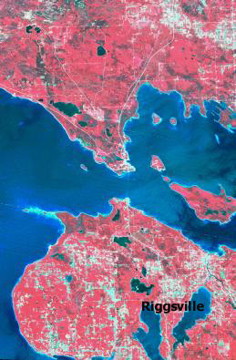
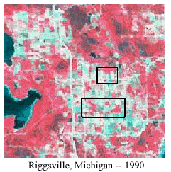
| These scenes of upper Michigan are taken from the Landsat Multispectral Scanner (MSS). The multispectral Scanner sensors are line scanning devices observing the earth perpendicular to the orbital track. The sensor captures backscatter or emitted electromagnetic radiation from the earths surface. We use sensors to record variations in the way earth surface features reflect and emit electromagnetic energy. This interaction between electromagnetic radiation and a specific landscape is measured and recorded based on the spectral, spatial, and radiometric resolution of a particular sensor system.
The colors you see in the image above is a false color composite. The red in the image is vegetation, while the light red to pink is agriculture fields, and the bright green to white is urban areas. The water is of course the blue area. The MSS sensor uses four spectral bands: red, blue, green, and near-infared.
|