Development of modeling tools for predicting smoke dispersion from low-intensity fires


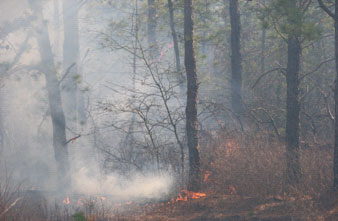
The overarching goal of this study is to adapt existing numerical models and decision support tools for predicting short-range smoke transport and diffusion from low-intensity fires. Our hypotheses are: 1) land surface characteristics, such as terrain and forest vegetation, and the near surface atmospheric processes induced by variations in land surface characteristics, can have significant impacts on smoke transport and dispersion from low-intensity fires, and 2) an improved understanding of these impacts will lead to better predictions of smoke transport and dispersion over areas of complex terrain and within and above forest vegetation layers. Simulating smoke from low-intensity fires is particularly challenging since smoke from low-intensity fires is very sensitive to near-surface meteorological conditions and terrain-induced local diurnal circulations. Smoke from low-intensity fires also responds to variations in vegetation cover and land use. Because smoke plumes from low-intensity fires can remain in the source area for relatively long periods of time, they are sensitive to the diurnal evolution of the atmospheric boundary layer. Finally, low-intensity fires often result in smoke that disperses beneath a forest canopy. To adequately describe within-canopy smoke transport and diffusion, the effects of forest vegetation on the mean wind flow and near-surface turbulence that governs the dispersal of plumes must be taken into account. Fortunately, these challenges can be met by taking advantage of the significant advancements in the development of regional-scale weather forecasting and atmospheric dispersion models.

(credit: John Hom, USDA Forest Service)
Department of Geography | College of Social Science | Michigan State University
208 Geography, East Lansing, MI 48824-1038
Tel: 517-432-4743 | Contact Webmaster
© 2010 Michigan State University Board of Trustees