THE WISCONSIN ICE ADVANCE
The land and water surfaces of
Michigan are largely the result of the sculpturing, erosion, and
deposition of materials during the last two million years�the Pleistocene
Epoch. Several stages of the continental glaciation affected the state,
but the most important was the most recent Wisconsin stage, which
retreated from Michigan about 9,500 to 15,000 years ago. Today�s water,
landforms, and soil characteristics and patterns are related to the nature
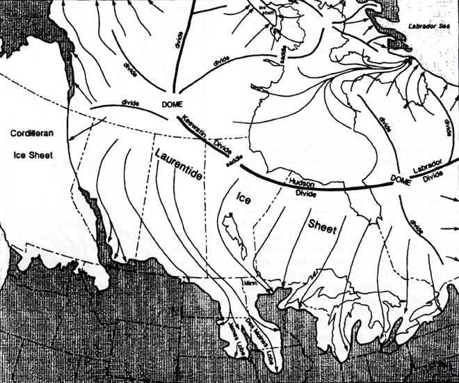
and results of the glacial processes. The image below shows the
extent of the Laurentide ice sheet at about 14,000 years ago.
("Laurentide" is the name given to the ice sheet that advanced into
Michigan from the Laurentian region of Canada.) This time
period does not mark the maximum extent of the ice in the
Great Lakes region (which occurred about 18,000 years ago), but it does
show nicely the major lobes of ice that
comprised the ice sheet.

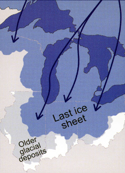
THIS image (below) shows the maximum extent of the ice
sheet in our region. Note that Michigan was totally covered by ice
at this time.

High areas of hard, resistant rock were smoothed off and in some localities (especially the western UP) were highly polished by the grinding, rasping, rubbing, of the debris-filled Wisconsin ice. In many places the smooth rock pavement is scored with scratches and grooves cut by the sharp rock tools held at the bottom of the glacier and given power by the weight and movement of the ice. These markings, or striations, wherever preserved on the old rock floor tell the direction of ice movement, since they always parallel the direction of ice advance. In deep valleys the advancing ice dumped some of its load and pressed the debris almost to hard firm rock by its own sheer weight.
This material has been compiled for educational use only, and may not be reproduced without permission. One copy may be printed for personal use. Please contact Randall Schaetzl (soils@msu.edu) for more information or permissions.