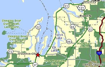
THE LAKES OF THE GRAND TRAVERSE AREA
The Traverse City area is replete with numerous lakes, most of which are long and narrow:
both the East and West Arms of Grand Traverse Bay, Torch Lake, Elk Lake, Lake Leelanau,
Lake Charlevoix, and many others. The origins of these deep and narrow lakes goes
back to the last ice advnace into Michigan. The Pleistocene Ice Sheet scoured out
these lake basins, and some think also deepened them by funneling large quantities of
fast-moving meltwater down through the valleys. The water would then have
"cut" these valleys, called "tunnel channels", into the soft sediments
below.
Note also that the lakes "splay" out, in a pattern like fingers on a hand. This is presumably due to the fact that the ice itself was splaying out when the valleys were cut.
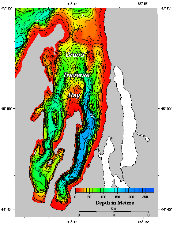
The bathymetric map below shows the great depths to which the Grand Traverse Bays have
been scoured.
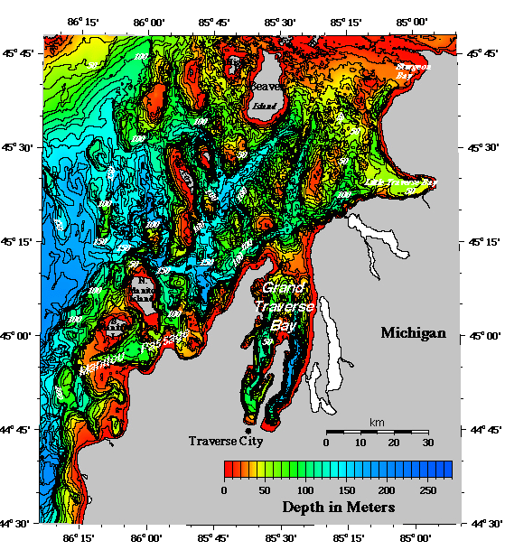
The bathymetric map below shows that the dep channels and glacial scouring continues into the offshore areas of Lake Michigan!
This material has been compiled for educational use only, and may not be reproduced without permission. One copy may be printed for personal use. Please contact Randall Schaetzl (soils@msu.edu) for more information or permissions.