SLEEPING BEAR DUNES NATIONAL LAKESHORE
As a shimmering blue Lake Michigan touches the northwest corner of the Lower Peninsula, rolling white perched dunes surrounded by lush forests and farm land provide a sharp geographic contrast that�s visible from outer space. Here you can find Sleeping Bear Dunes National Lakeshore (SBDNL) � a place where geologic wonders intersect with Chippewa Indian legend and modern Michigan recreation.
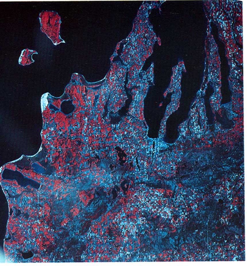
In this computer-enhanced satellite picture, Sleeping Bear National Lakeshore appears from space as a white mass. North and South Manitou Islands are visible off the coast. (Photo credit: NASA, reprinted in Sleeping Bear: Yesterday and Today.
THE GEOLOGIC HISTORY OF SLEEPING BEAR
The present Sleeping Bear National Lakeshore can trace its origins to the Wisconsin Glaciation, which left the area roughly 11,000 years ago. During this time, the huge moving masses of ice deposited significant quantities of sediment at glacial borders or margins. Known as �end moraines� or "heads of outwash", these landforms contain an irregular mix of debris such as rocks, sand, gravel, and clay. One particular end moraine, known as the Manistee Moraine, forms the uplands near Sleeping Bear. The dunes at Sleeping Bear are known as perched dunes, for they stand atop the glacial deposits below. That is, much of the bluff and uplands of SBDNL are glacial deposits, not sand dunes per se.
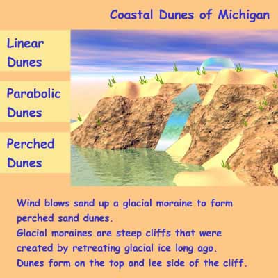
This illustration shows how perched dunes are formed.
(Illustration credit: Dr. Susan E. Hill, Animation and Web Design Coordinator for the Tech Alive project at Michigan Technical University as part of the Michigan Environmental Education Curriculum, http://techalive.mtu.edu/meec/module09/DuneTypes.htm)
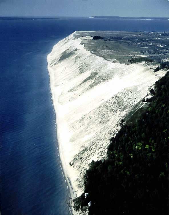
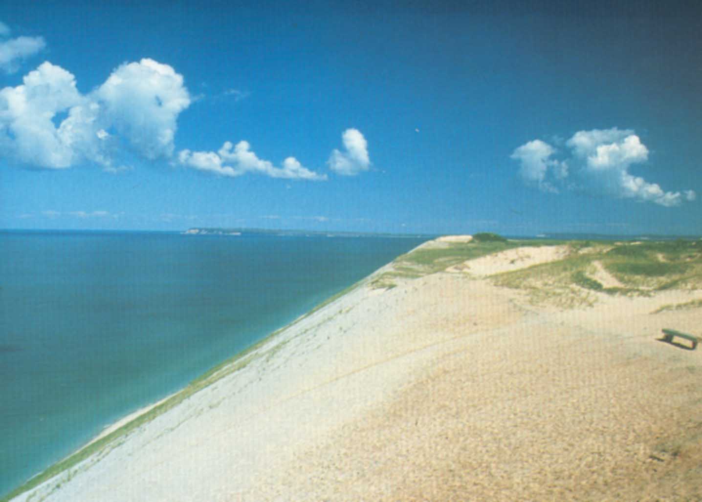
Present day image of Sleeping Bear National Lakeshore (Photo credit: Public domain image courtesy of the National Park Service)
ORIGINS OF SLEEPING BEAR DUNES
According to Chippewa legend, Sleeping Bear received its name from the misfortune of a mother bear and her two baby cubs. After a summer of intense drought, the forested Wisconsin home of the bear and her cubs caught fire. Seeking to protect her young from the blaze, she led them to Lake Michigan and swam across. Being older and stronger, the mother bear reached the shore first, climbed up on the large coastal bluff, and looked out over Lake Michigan to watch and wait for her young cubs. Time passed, however, and the little bears never reached the shore, having drowned in their exhaustion along the way. Realizing her loss and great misfortune, the mourning mother bear fell asleep on the bluff and died from grief. Moved by these tragic events, the Great Spirit Manitou raised two islands to mark the places where the two cubs drowned and forested the place where the mother bear waited for her cubs. This solitary forest land surrounded by sand served as the origin for the name �Sleeping Bear.�
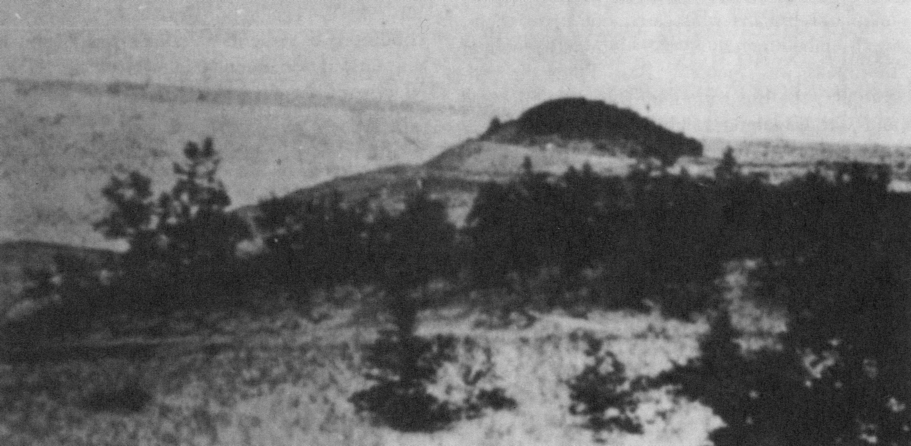
In this 1907 picture of Sleeping Bear Dunes shows the solitary forest which resembles a large sleeping bear (Photo credit: National Park Service)
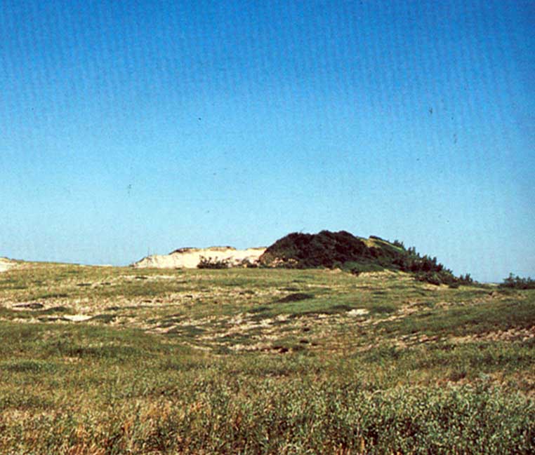
After 82 years of erosion, the sleeping bear is hardly visible in this 1989 photo (Photo credit: National Park Service)
MODERN SLEEPING BEAR DUNES NATIONAL LAKESHORE
Since the Sleeping Bear area became a national park in 1977, it has become the scene for a variety of recreational events. People can climb the dunes in the summer � a climb that is a steep 1.5 miles. In addition, the area boasts the Pierce Stocking Scenic Drive which winds through the dune region and has stunning views of Lake Michigan. The National Park Service also advertises the park as a strong place for backpacking, bird watching, boating, camping, cross country skiing, fishing, hiking, hunting, kayaking, scuba diving, snorkeling, snowshoeing, stargazing, swimming, and wildlife viewing. For those interested in Michigan history, the area also has several museums, including one that details the numerous shipwrecks off the Sleeping Bear and Manitou coasts. Snorkelers and scuba divers can even see the remains of numerous ships that met misfortune in this area long ago. Regardless of your interest, the area has several scenic views sure to interest anyone wanting to sample a unique part of Michigan.
Information for this project was gathered from the following sources:
National Park Service. �Sleeping Bear Dunes National Lakeshore� project..nps.gov/slbe/index.htm.
Weeks, George. Sleeping Bear: Yesterday and Today. Franklin, Michigan: Altwerger and Mandel Publishing Company, 1990.
Page created by Alison Eber, a GEO 333 student
This material has been compiled for educational use only, and may not be reproduced without permission. One copy may be printed for personal use. Please contact Randall Schaetzl (soils@msu.edu) for more information or permissions.