ROCK TYPES AND ROCK STRUCTURE OF THE UP
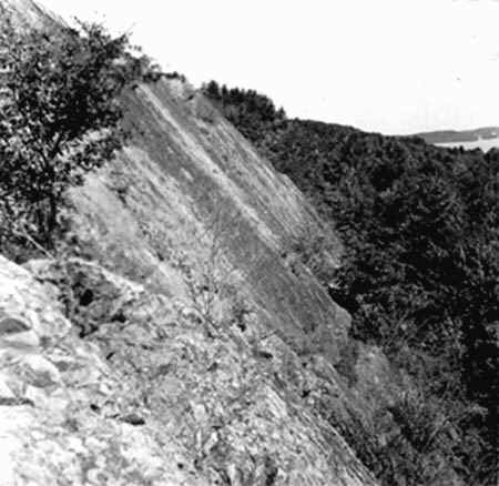
The image below shows the steep dip associated with the rocks of the Marquette syncline.
This photo was taken near Ishpeming, and illustrates the north limb of the syncline.
Source: Unknown
Source: Unknown 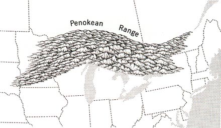
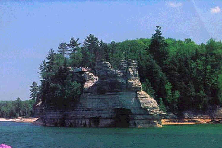
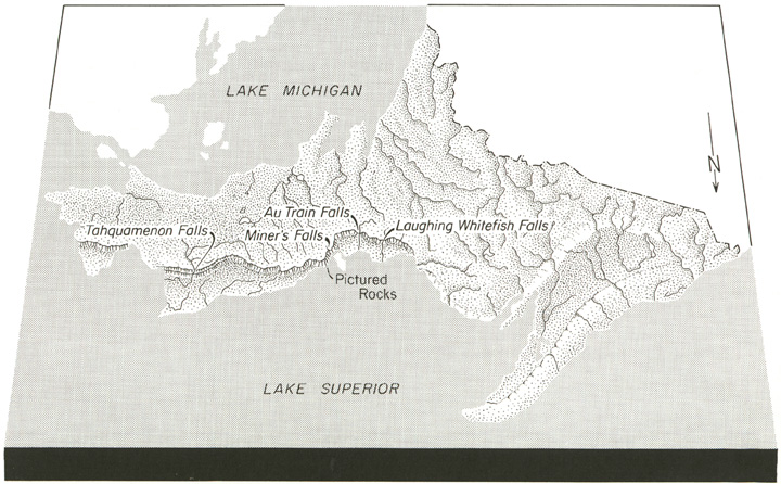
The Late Precambrian (or Early Cambrian) sandstones of the northern and eastern UP are
highly prized by tourists. These rocks are visible at Pictured Rocks National
Lakeshore.
Source:
Photograph by Randy Schaetzl, Professor of Geography - Michigan State University
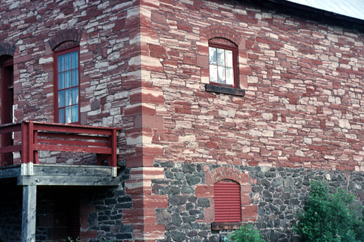
The Jacobsville sandstone, one of the most beautiful rocks in Michigan and also a
sandstone formed during the Cambrian, is quite impressive as a building stone. In
many parts of the UP, one can observe buildings made of the Jacobsville sandstone (see
below).
Source:
Photograph by Randy Schaetzl, Professor of Geography - Michigan State University
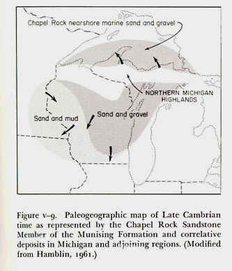
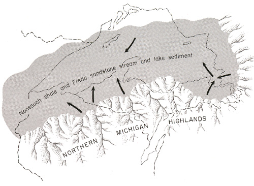
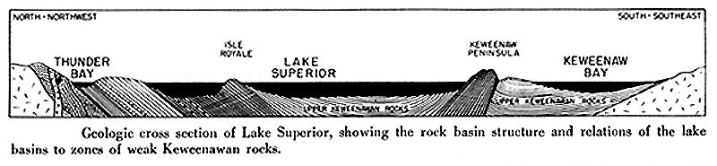
Most of the sedimentary rocks of the UP were deposited in a shallow sea that existed where
Lake Superior is today. Although we know where the approximate southern edges of
this sea were (see below), we are less sure of its northern and western boundaries.
Glacial erosion has scoured away many of the sedimentary sandstone rocks that would have
been there, leaving behind only the crystalline, Precambrian rocks that previously lay
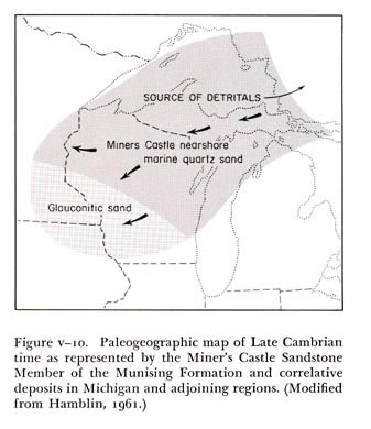
under the sandstones. Below are two paleogeographic maps that show what the
landscape might have looked like at the Precambrian-Cambrian time period, and where the
sandy sediments for the sandstones of this period may have been derived from.
Source: Unknown
Source: Unknown
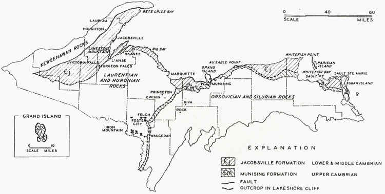
How thick were these sandstones? The maps below give us an indication that the
Jacobsville sandstone, one of the major sandstones of the UP, is over a 1000 feet thick at
the lakeshore, but thins to nonexistence within a few tens of miles to the north.
Thickness of the Jacobsville sandstone (feet)
Source:
Unknown
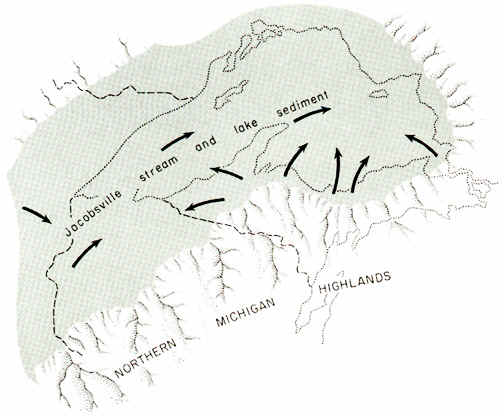
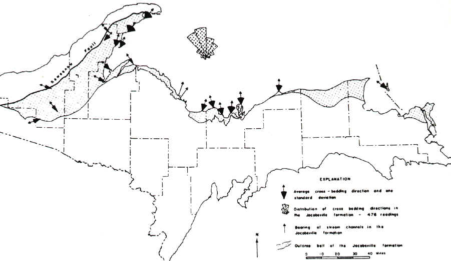
By examining the directions of ripple marks and bedding indicators within the Jacobsville
Sandstone, geologists have determined that it was being laid down into a sea by rivers
coming from the north. (See map below.)
Source: Unknown
Source:
Unknown
The Cambrian sandstones are important reservoirs of groundwater in the Northern Peninsula. The red Jacobsville sandstone, a good building stone, was formerly quarried at Jacobsville and used for building purposes until shipping costs and cheaper cement-concrete materials made production costs prohibitive. Michigan has large reserves of sandstone in the Peninsula. Near the top of the AuTrain formation the sandstone is free enough of impurities to make it a potential source of glass sand. At present probably the tourist receives greatest value from the sandstone in viewing the scenic effects produced by weathering along exposed edges at the lake shore, and in the little gorges cut back into the cliffs by rivers--Pictured Rocks, Miner’s Castle, Miner’s Falls, and many others.
Source: Unknown
Source: Physical Geography of Wisconsin, Martin.
Source: Unknown
Source: Unknown
This material has been compiled for educational use only, and may not be reproduced without permission. One copy may be printed for personal use. Please contact Randall Schaetzl (soils@msu.edu) for more information or permissions.