MORAINES
As the ice receded, it stopped at various points and built up landform features known as
end moraines--ridges that vary in height and composition depending on the length of time
the ice remained at a particular point and on the materials being eroded.
Moraines are landforms created directly by the wasting ice sheet. Often
they are composed of glacial till--a sediment of mixed character, with many rocks and
stones, laid down as the ice rapidly melts. There are several different subtypes of
moraines.
End moraines are irregular ridges of glacial sediments that form at the
margin or edge of the ice sheet. These landforms represent a stillstand of the ice, having
formed as the ice margin remained in one position while internally the ice was bringing
sediment forward and continuously depositing it at the margin. Alternatively, end moraines
may form as a glacier readvances and "pushes" soft sediment in front of it,
creating what is often called a small "push moraine". The outermost end moraine
is given the special name "terminal" end moraine. All others are referred to as
recessional moraines, since they mark a recessional position of the ice margin.
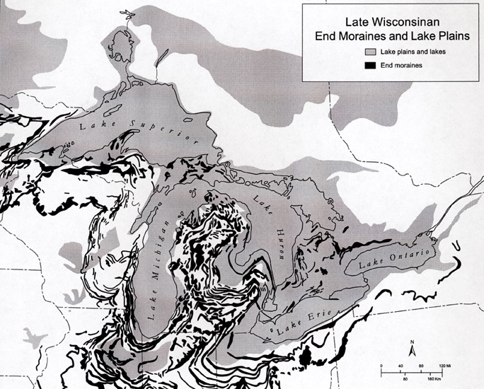
End moraines, shown below in black, are ridges of glacial drift,
usually glacial till, that form at the edge of the ice sheet. That is, they are
"ice-marginal landforms". Moraines are typically rolling landforms,
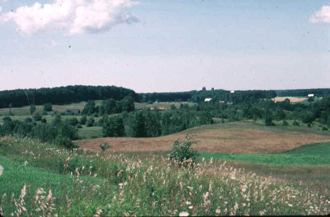
higher than the surrounding countryside. The image below is of the impressive Port
Huron moraine.

Each moraine marks the former position of the ice margin, where it stabilized for a few
decades or so. Sometimes, the moraines mark the end of a major glacial readvance, where
the retreating ice sheet stopped retreating and readvanced, pushing material ahead of it
and forming the moraine. At other times, they mark the location where the ice front paused
for some time, probably because the rate of advance of the ice (internally) equaled the
rate at which melting was occurring.

Each moraine forms an upland landscape, where the soils are usually
drier. However, end moraines are often rolling and quite hilly, and for that reason many
are forested today--the slopes are too steep for long-term cultivation. Note how the
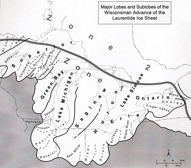
moraine "loops" follow the outlines of the major ice lobes that entered the
state.

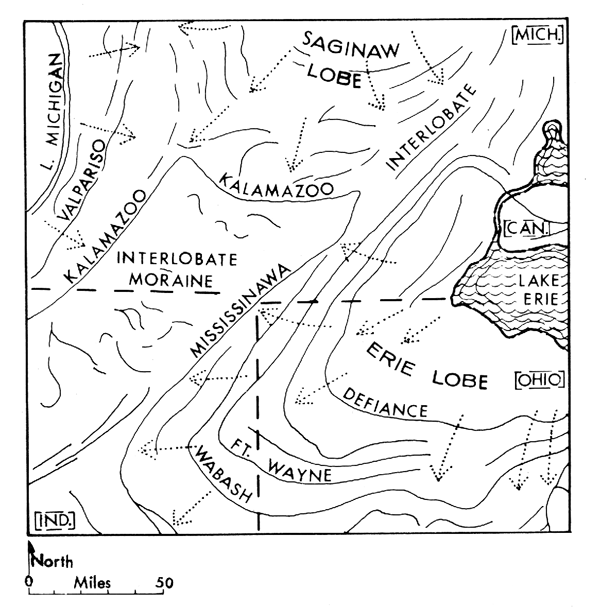
Most of the moraines in Michigan are named for nearby localities. The
map below provides the names of some of the larger moraines in SW Lower Michigan. The west
suburbs of Chicago lie on the Valparaiso moraine, where it swings into Illinois. The large
hills near the Kellogg Biological Station are part of the Kalamazoo moraine.
The Saginaw lobe was thinner than the Lake Michigan and Erie lobes and therefore melted
faster and was the first to begin its retreat. Its first halt after uncovering an area of
four or five townships in St. Joseph and Cass counties was near Sturgis, where it built
the first and oldest moraine in Michigan --- a line of hills passing through Sturgis and
bordering the triangular area first uncovered. This hilly ridge has been named the Sturgis
moraine. From this outpost the lobe receded step by step into the Saginaw Valley, and at
each halt built a moraine, so that its retreat across Michigan is marked by a succession
of more or less parallel moraines closing in on Saginaw Bay from the south, with their
ends tied to the massive moraines of the Erie lobe in the east and the Lake Michigan lobe
in the west.
After its brief stop at Sturgis, rapid melting caused the Saginaw lobe
to retreat to the position of Tekonsha where it built the slender Tekonsha moraine.
Further retreat brought the Saginaw ice front to the position of the large and wide
Kalamazoo moraine. Here it halted long enough to build up a high, wide, massive, very
hilly range. The Kalamazoo moraine extends from Hastings south and east through Marshall
to Devil’s Lake in Lenawee County where it connects with Mississinawa moraine which
outlines the outermost position of the Erie lobe in southern Michigan. On the west the
Kalamazoo moraine of the Saginaw lobe unites with the moraine also called Kalamazoo, which
the Michigan lobe was making at that time, extending from Hastings through Kalamazoo and
Cassopolis. This Outer Ridge of the Kalamazoo moraine marks the most easterly extent of
the Lake Michigan lobe. From this time the pattern of moraines records the retreats and
halts of all the glacial lobes --- Erie, Huron, to the east, Lake Michigan in the west,
and the Saginaw lobe between, and the Superior lobe in the north.

This material has been compiled for educational use only, and
may not be reproduced without permission. One copy may be printed for personal
use. Please contact Randall Schaetzl (soils@msu.edu)
for more information or permissions.