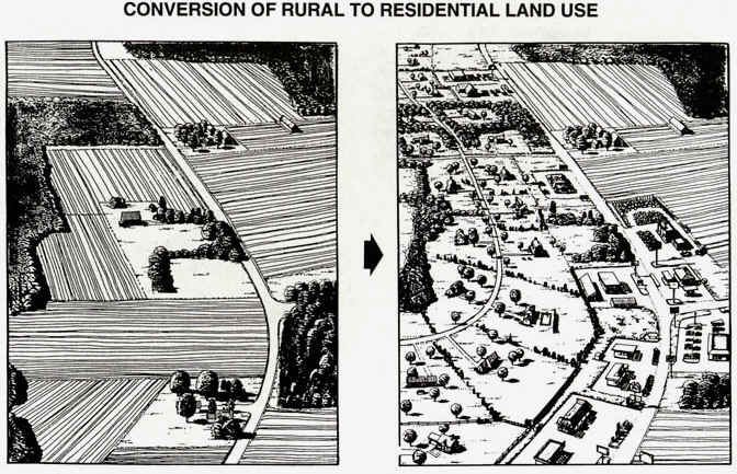
LAND CONVERSION
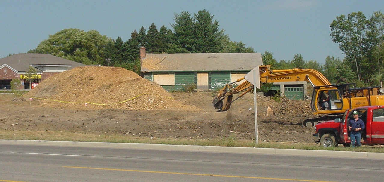
Loss of farmland is a major problem in Michigan and elsewhere. Every day, acres of
agricultural land is converted over to other uses, such as housing, suburban development,
and highways. In the image below, the remains of a small grove of trees (now a pile
of wood chips) and the old farmhouse (green walls, boarded windows) are yielding to the
development of a new bank/shopping center. The site is Meridian Township, east of
Lansing.
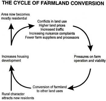
As of the late 1990's, TEN ACRES of farmland was being lost to development every hour of every day. That's a square mile lost to development every 2.6 days! Farmland conversion occurs because of a vicious cycle, shown below:
Source:
Central Michigan University
This "placemat" map was produced by the Michigan Geographic
Alliance and the Science/Mathematics/Technology Center, Central Michigan University, with
funding from the U.S. Dept. of Education. For further information email
Wayne.E.Kiefer@cmich.edu
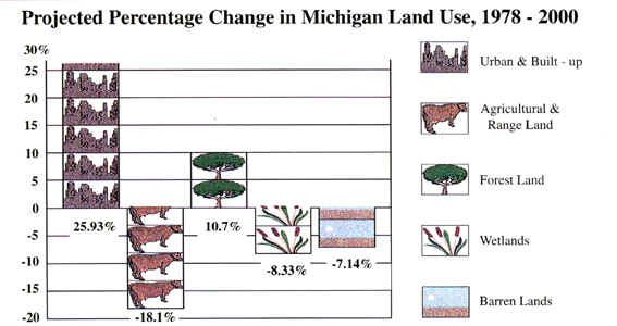
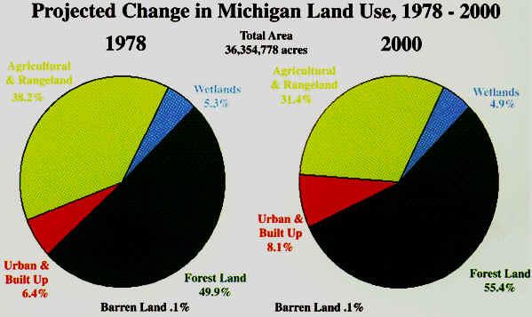
It’s projected that in 20 years, farmland acres in Michigan will be reduced from the
current level of 10.1 million acres to between 8.1 and 8.6 million acres, according to the
DNR.
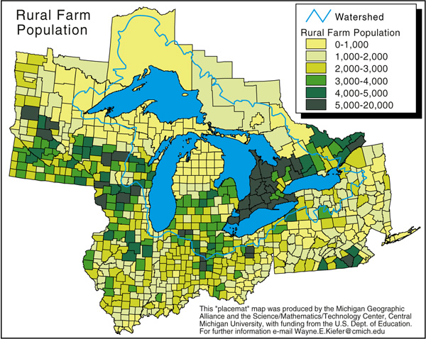
This "placemat" map was produced by the Michigan Geographic
Alliance and the Science/Mathematics/Technology Center, Central Michigan University, with
funding from the U.S. Dept. of Education. For further information email
Wayne.E.Kiefer@cmich.edu
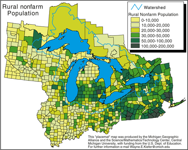
This "placemat" map was produced by the Michigan Geographic
Alliance and the Science/Mathematics/Technology Center, Central Michigan University, with
funding from the U.S. Dept. of Education. For further information email Wayne.E.Kiefer@cmich.edu
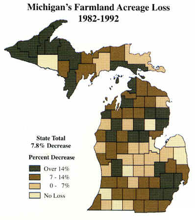
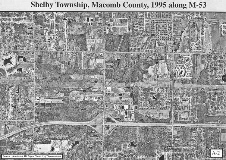
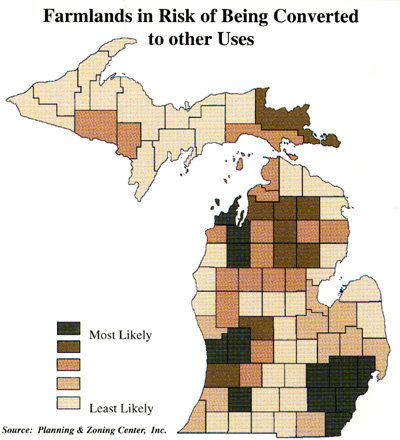
The two maps below, on a county basis, the loss of farmland in Michigan over two different
timescales. Note the different patterns for these different time periods.
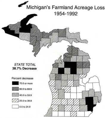
Source: Michigan Trend Futures Report, Michigan Society of Planning, 1997
In order to get a feeling for the tremendous loss of farmland to urban and other uses, view the two images (of the same area) below, both of which were produced by the Michigan Geographic Alliance and the Science/Mathematics/Technology Center, Central Michigan University, with funding from the U.S. Dept. of Education. For further information email Wayne.E.Kiefer@cmich.edu
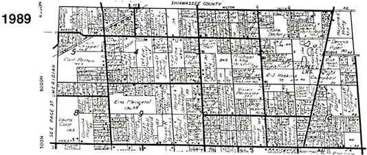
Here's another look at this pattern for Williamston township (just east of Okemos):
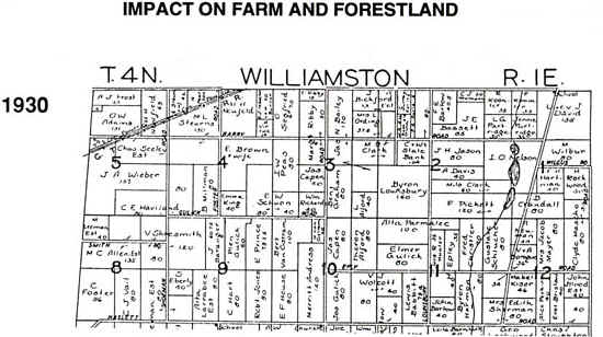
Source: State of Michigan
Notice the large land parcels in the 1930 map above, most of which are farms. By
1989, most of these farms had been subdivided into small parcels, for housing.
Source: State of Michigan
This "placemat" map was produced by the Michigan Geographic
Alliance and the Science/Mathematics/Technology Center, Central Michigan University, with
funding from the U.S. Dept. of Education. For further information email
Wayne.E.Kiefer@cmich.edu
This "placemat" map was produced by the Michigan Geographic
Alliance and the Science/Mathematics/Technology Center, Central Michigan University, with
funding from the U.S. Dept. of Education. For further information email Wayne.E.Kiefer@cmich.edu
Source: Michigan Trend Futures Report, Michigan Society of Planning, 1997
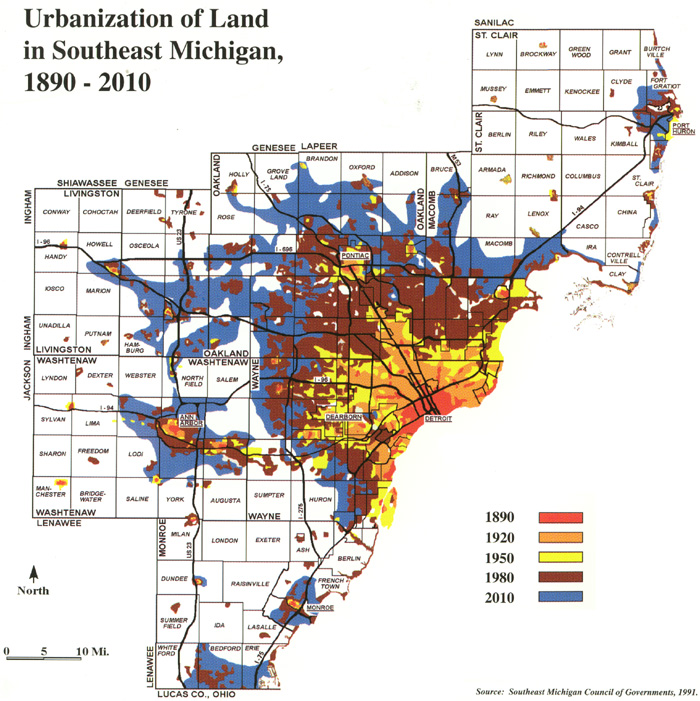
Can you find any pattern in the locations of the "at risk" areas? What types of current land use are they all near?
This material has been compiled for educational use only, and
may not be reproduced without permission. One copy may be printed for personal
use. Please contact Randall Schaetzl (soils@msu.edu)
for more information or permissions.