Logging and milling had begun in earnest between 1830 and 1840. In general, the pine lands and the central, southern, and eastern areas were logged first and most completely, and were then subject to damaging fires which followed. These were the drier sites which had most pine to begin with, and were so situated and continuous as to be in the paths of many fires which raced from west to east with the prevailing winds. These were also the areas in which ill-advised agricultural efforts, encouraged by land speculators, stimulated land clearing by early settlers. Patches of timber of varying size, protected on the west by either open water or wet swamps, or to a lesser extent, hardwood sites, escaped some of the fires which swept around them, but sooner or later many of these burned too.
Northern hardwood (maple, beech, basswood) forests seem to have suffered less from the combination of drastic cutting and fires. Swamp conifer stands, in wet sites, were least subject to loss from fire. Settlers were not tempted to clear these wet lands for farming. Once the old white pines were cut from the swamps, in many places natural regeneration and growth followed, resulting in the continuation of the forest conditions.
Forest fires in many extensive areas not only killed the trees and consumed the thin mantle of topsoil and eliminated every possible source of seed or sprouts to bring back the previous forest. In some areas, notably parts of Kalkaska, Missaukee, Crawford, Osceola, Wexford, Luce and Clare counties, even today areas of fire-charred pine stumps on otherwise almost barren sand plains are to be found. The Kingston Plains is an excellent example of this type of landscape. Early farming efforts, many of which failed, were responsible for completely denuding land, which was then (of course!) later abandoned.
After the great logging era of the late 1800's, most of the
pine lands were piled with "slash" -- branches and drying wood scraps. These
quickly burned, and often repeatedly burned.
The land then became barren, expect for a few stumps that were more
resistant to the fires. Most of these burned-over barrens soon regenerated to forest. In
many areas, however, the stumps remain, even though it has been over a century since they
were living white pine trees. In many areas, wind eroded most of the upper horizons of the
soil (see below).
In others, the land was converted to agriculture, with grazing dominating until the
farmers could remove the stumps.
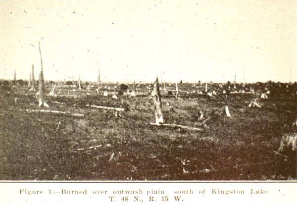
One area that has remained in stumps and has not regenerated to forest
lies near Pictured Rocks, in the central UP. This area, the Kingston Plains, is a often
referred to as a "stump prairie". The Kingston Plains, a flat, sandy landscape,
contained a large white pine forest at the time of logging: the 1890's. The image below
shows what this landscape looked like in 1935.
The image below shows the Kingston Plains in 1968.
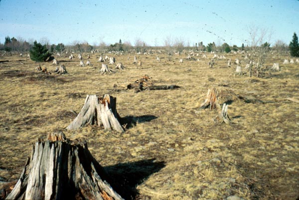
Source: Image Courtesy of Loren Berndt
And again, here (below) is what the landscape looked like in 1995. It is still a
stumped landscape!
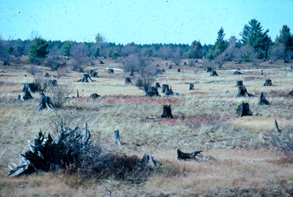
Source: Photograph by Randy Schaetzl, Professor of Geography - Michigan State University
The real question is, "Why has this landscape not revegetated?" Geographer
Linda Barrett studied this question and concluded that the "pure" white pine
areas were so vast and the slash must have burned so hot in those areas, that few trees
(and hence, few seeds) were left to provide for new seedlings. Also, the fires were
probably so hot in this area that the soil---dry, infertile, and sandy to begin
with---literally "cooked" itself.
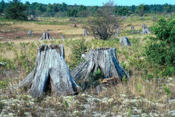
Source: Photograph by Randy Schaetzl, Professor of Geography - Michigan
State University
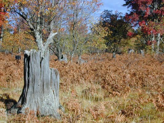
There are many other areas in Michigan that also are "stump prairies", like the
area near Farwell, the sandy plains east of Mancelona, and the area near the old logging
town of Deward. The image below is from an area near
Deward, which, presumably, has a similar logging and land use/abuse history as does the
Kingston Plains.
Source: Photograph by Randy Schaetzl, Professor of Geography - Michigan
State University
There are also many, many fully-grown hardwood stands in Michigan that DID regrow
successfully after the loggers left. One can still find stumps in these stands--a
testament to the fact that white pine was a component of the forest there as well.
Source: Photograph by Randy Schaetzl, Professor of Geography - Michigan
State University
However, because the stands were not pure pine they were not completely
logged, and the ensuing fires were not as large. Seed sources remained and the soil
"survived", and hence the forest regrew. Sites which
look devastated, would regrow into dense forest. However, where ALL the trees were
cut, only stumps remained, and would remain, for years.
This material has
been compiled for educational use only, and may not be reproduced without
permission. One copy may be printed for personal use. Please contact
Randall Schaetzl (soils@msu.edu)
for more information or permissions.