INLET LAKES
Inlet lakes occur along the shores of the Great Lakes, and are particularly common along
the Lake Michigan shore. They occur due to two main processes of landscape
development. First, during the Holocene, when lake levels were low, rivers draining into the Great Lakes incised their valleys,
creating deep valleys that entered the lakes (i.e., fluvial incision). Later, lake levels
rose, drowning these old river valleys. Finally, longshore transport of sand along
the beach front has created spits and finally joined these sandy spits across the
baymouth, effectively "sealing off" the old river valley mouth to form an
inlet lake (i.e., coastal processes). The sandy spits that separate the two lakes
are called "baymouth bars".
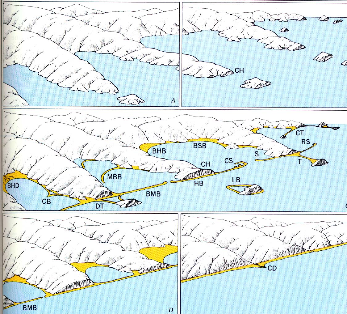
The process by which a drowned river valley becomes an inlet (or baymouth) lake is
shown below. Note the two inlet lakes in the lower left part of the diagram, and the
baymouth bars (BMB) that seal them off.
Click here for full size image (310 KB)
The images and maps below show but a few of the many inlet lakes in the state.
If the lake is small and has no or only a small stream entering it, such as the one
below, the lake may have no outlet. That is, the water entering it may leave as
groundwater.
However, when the lake has a significant river flowing into it, the inlet lake will
have been able to maintain it's outlet to Lake Michigan, despite the fast pace at which
sand is being deposited in the spit that forms the "dam" between it and the main
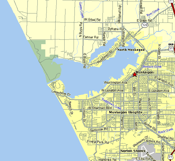
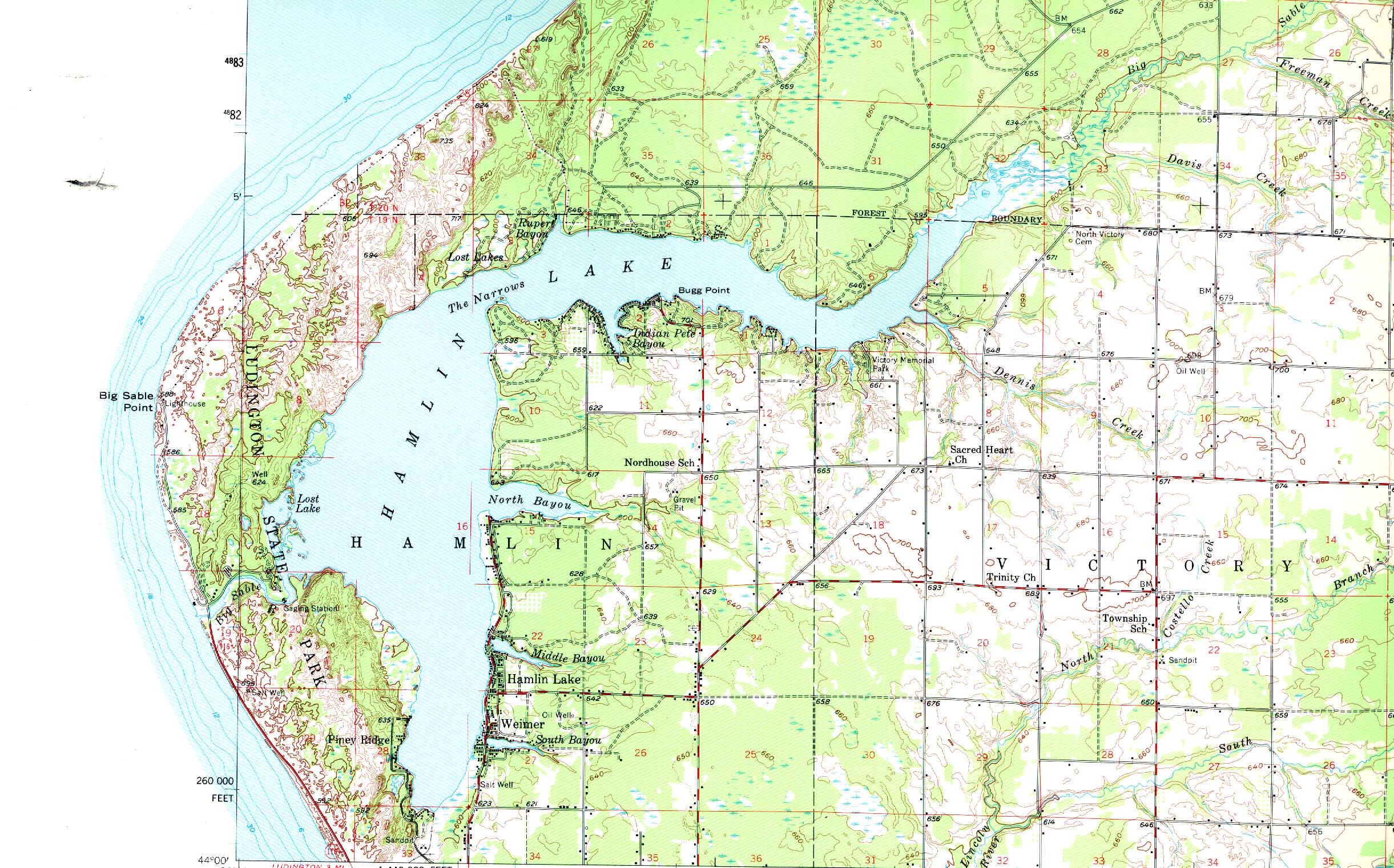
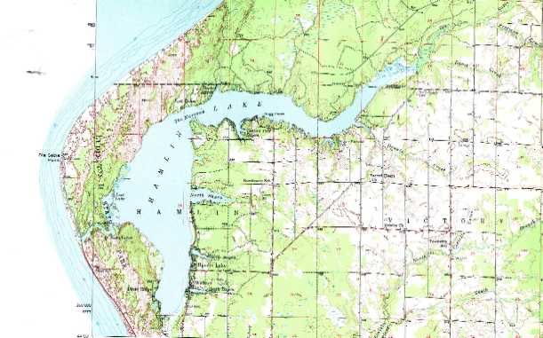
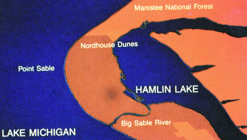
lake (Michigan). Thus, Hamlin Lake (below, north of Ludington) maintains an outlet
to Lake Michigan even today. The sand barrier on many lakes, like the one between
Hamlin Lake and Lake Michigan, is often capped with sand dunes.
Click for full sized image (574K) |
Click here for printable size
(Hamlin Lake is in Mason County, just north of Ludington.)
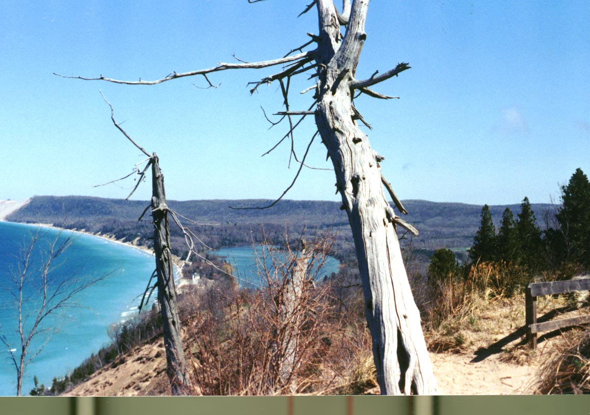
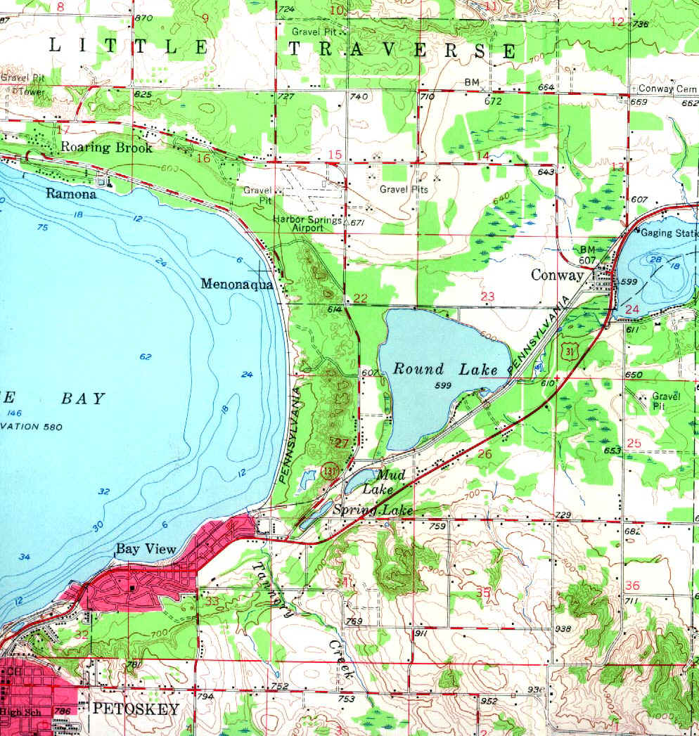
At the far eastern end of Little Traverse Bay lies the city of Petosky, and the inlet lake
known as Round Lake (see below). Petosky State Park is found within the sand barrier
that lies between Round Lake and Little Traverse Bay (Lake Michigan).
This material has been compiled for educational use only, and
may not be reproduced without permission. One copy may be printed for personal
use. Please contact Randall Schaetzl (soils@msu.edu)
for more information or permissions.