GRAND SABLE DUNES

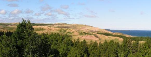
The Grand Sable Dunes, located in Alger County, are some the world�s most pristine perched dunes. They cover a five mile stretch between the Sable River and Au Sable point.
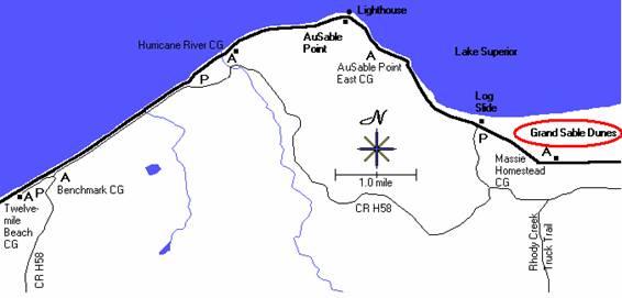
Where Exactly are the Dunes Located?
The Grand Sable Dunes are located in the Pictured Rocks National Lakeshore in Alger county.
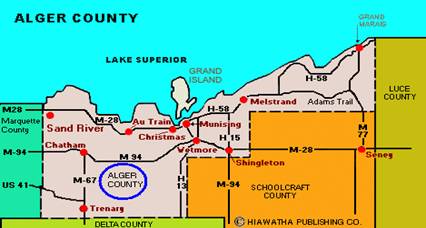
Best Place to see the Dunes
If you plan on taking the hike to the Grand Sable Dunes the best way to get there would be to take the trail that starts at the west end of the Sable Falls parking area. While on the trail you will walk through an old field and eventually cross over a bridge that runs about Sable Creek. For the next � mile you will go through the forests and dune transition areas. Along the trail, stop and take a look at the wayside exhibits. Another way to access the dunes is through the north country trail while is located � mile east of the log slide.
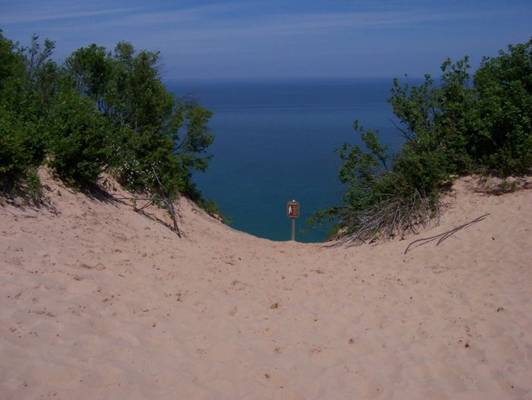
Glacial History
Glacial ice that melted within the Superior Basin produced many large rivers after the last major readvance, The Marquette readvance, in North America. These rivers deposited millions of tons of debris into many different configurations south of the Superior Basin. The Grand Sable Banks may have originated as a glaciofluvial kame terrace along one of these glacial rivers during deglaciation.
Pictured rocks then became very dry about 9500 years before present due to the Lake Superior basin draining to the north. The outlets to the east were now the low spots. A north facing ice contact bluff and a platform to the south of it remained in place for 4500 years after deglaciation right around the area where Grand Marais is located today.
Isostatic rebound then occurred about 4000 to 6000 years before present. North Bay began to rise which caused water levels to rise rapidly. In fact, Lake Superior rose to about 40 feet higher than it is today! The rise in lake levels formed Lake Nipissing. Lake levels of Lake Nipissing also began to rise which caused the Grand Sable Banks to become unstable. From this point the formation of a perched dune can explain how the dunes formed from the Grand Sable Banks.
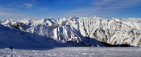
Perched Dune Systems
The Grand Sable Dunes as well as the Sleeping Bear Dunes are examples of �perched dune systems�.
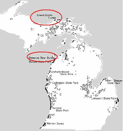
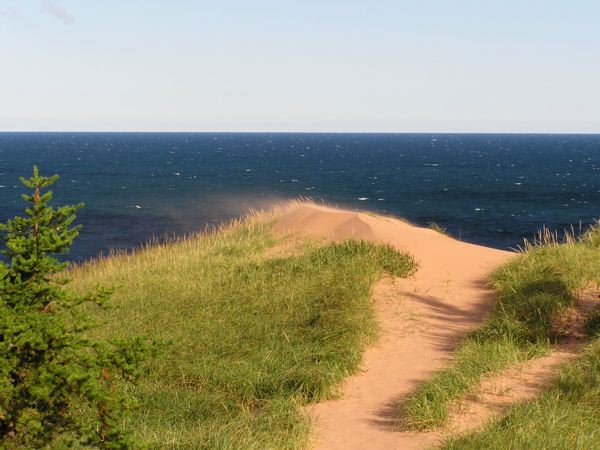
When Lake Nipissing water level rose it caused the Grand Sable Banks to become unstable. In turn, the high water eroded the bluffs which left them exposed to wind. A dominant northwesterly wind blew through the Grand Sable Banks which carried the wind from the bluff to the top of the flat upland. This sand was �perched� on top of the upland, hence the name, �perched dune system.�
Climate at the Dunes
The climate of the Grand Sable Dunes, humid continental, is typical of any Michigan climate. The winters are fairly long and cold while the summers are short and cool. The location of the dunes happens to be the second most cloudy area of the United States. The average cloud cover is approximately 70%. Grand Marais� annual temperature is 40.8 degrees Fahrenheit with precipitation totaling 31 inches a year. During the winter season snowfall accumulation ranges from 130 to over 200 inches. Because the dunes are so close to Lake Superior extreme low temperatures in the winter and extreme high temperatures in the summer do not occur.
Changing Vegetation: An Increase in the Jack Pine Forest
Scientists who are studying vegetation changes at the Grand Sable Dunes have found that there has been an increase in the number of jack pine forests throughout the past 100 years. Typically jack pine forests are found in these locations�
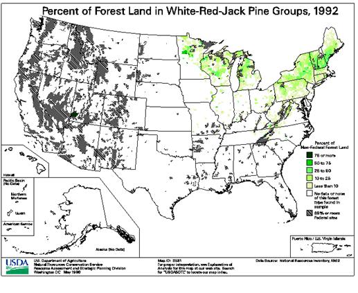
Jack pine forests have multiplied at an astonishing rate. There has been a fivefold increase in forest cover within the last 50 years. Similar finding are also occurring at Sleeping Bear Dunes.
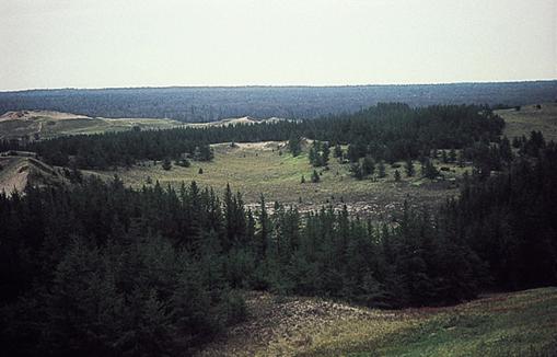
By studying stand-age (a stand is a specific area of land which consists of a uniform type of forest) within the forest patches of the Grand Sable dunes researchers have concluded that afforestation (afforestation is planting of trees for commercial purposes) began at the landward edge of the dunes about 125 years ago. As stand age increase (a certain area of land that contains a uniform type of forest gets older) so does the forest�s richness. The richness is also higher in the forests that increase with stand-age than that of the fire-influenced pine stands which are located to the south and to the east of the dunes.
By doing soil profiling, charcoal from ancient times has proposed vegetation that was fire-prone occurred there in the past and species associated with fire (blueberries, wintergreen) are no longer located in modern-day forest patches.
Overall there seems to be a drift occurring at Grand Sable Dunes that is swaying toward more forest cover. Due to the stability of the dunes within the past 150 years, jack pine forests have increased rapidly in parts of the central and eastern dunes. The red pines were buried approximately 500 years before present during a time in which they were increasing in numbers at the dunes as well. Because of the length of time in between stable and unstable periods during the late Holocene, species that are more adaptable to open sites with a large supply of sand are alternately favored in comparison with species that are well adapted to shade sites. The fluctuating water levels of Lake Superior may control this alternating of species at the dunes.
Preserving the Grand Sable Dunes as well as the Pictured Rocks National Lakeshore
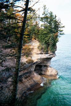
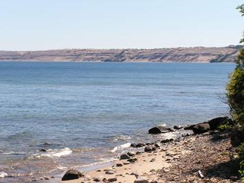
As tourism increased in the 1950s, so did the push for the Pictured Rocks to become a state park. A 1953 staff report described the area as "one of the most significant sites in Michigan." Plans were drawn and maps were made to get a project underway to turn Pictured Rocks into a state park. Here in the region of the Pictured Rocks," the Conservation Department resolved, "is an area with all the attributes of an outstanding state park--superlative natural beauty that should be preserved for the lasting enjoyment of the people and to the economic benefit of the region." Unfortunately, the development of the park never went past the mapping stage. About twenty years before the attempt to create a state park at Pictured Rocks there was also an attempt to turn the Grand Sable Dunes into a state park, however, the proposal was never followed through. This project was thought to be a good idea since the dunes were located on 1,500 acres of tax-delinquent land. The state did not have to spend any money to purchase the dunes.
All of a sudden in 1953 Pictured Rocks were on the agenda once again. There was renews interest in making it a state park. That year also boasted an enormous 14 million visitors to state parks. Unfortunately though the Conservation Department received little more than 10 cents per visitor to pay not only for all maintenance but to fund new facilities as well. To combat this problem the state decided that a $2.00 pass (per year on automobiles) would be required for entry into all state parks. Six years later, in 1959 there simply was not enough revenue coming in and the state parks were weighing heavily on the economy of Michigan.
Despite Michigan�s economic hardship, state park acreage increased by more than double between 1948 and 1972. Because the Grand Sable Dunes and the Pictured Rocks were located in a remote part of Michigan, no expansion of parks took place there. It was also felt that there was no threat to the environment at the Grand Sable Dunes and Pictured Rocks because it was no visited frequently. "What about the Rocks?" a Munising News editorial asked in 1954 when other acquisition and development projects were funded. Unfortunately for Alger County, it was neither big enough nor strong enough to be able to tap into a tight state budget.
As time went on more and more people were pushing for the Grand Sable Dunes and Pictured Rocks to become a state park. After many bills were sent to the state and many years of fighting for the park, on October 15, 1966 the Pictured Rock National Lakeshore was proclaimed a state park. �In order to preserve for the benefit, inspiration, education, recreational use, and enjoyment of the public a significant portion of the diminishing shoreline of the United States," Lyndon Johnson signed Public Law 89-668 creating the first National Lakeshore at the Pictured Rocks.
Today, you can find the Grand Sable Dunes as well as many other beautiful attractions within the Pictured Rocks National Lakeshore.
REFERENCES
Grand Sable Dunes Research Natural Area. National Park Service.12 Apr. 2005 <project..nps.gov/piro/GrandSablRNA04.pdf>.
Loope, Walter l., and A. K. McEachern. Habitat Change in a Perched Dune
System Along Lake Superior. U.S. Geological Survey. 10 Apr.
2005 <http://biology.usgs.gov/s+t/SNT/noframe/gl128.htm>.
Karamanski, Theodore J. THE PICTURED ROCKS: An Administrative History of. Omaha: US Dept of the INterior, 1995. 49-125.
PHOTO CREDITS
In order�
GEO 333 webpage
http://biology.usgs.gov/s+t/SNT/noframe/gl128.htm
Page created by Samantha Rapson, a GEO 333 student
This material has been compiled for educational use only, and may not be reproduced without permission. One copy may be printed for personal use. Please contact Randall Schaetzl (soils@msu.edu) for more information or permissions.