ESKERS
In over a thousand places in the State we find long
narrow hills that look like abandoned railway embankments and locally are
called "hogsbacks" and "Indian trails." Geologically these hills are
eskers --- long narrow winding ridges of stratified gravel, sand and silt.
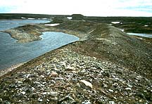
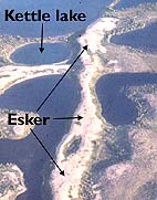
They formed under stagnant rather than moving ice. Often not recognized as
being glacial features, are the low, sinuous hills that can stretch for
miles and often resemble snakes when seen from the air. These are
eskers.
An
esker is an ancient river bed that has been formed inside or on top of a
glacier. As meltwater seeks to escape from the lower levels in the
glacier, it forms channels along zones of weakness and eventually emerges
from under the ice at the glacial margins. In its passage, the water
transports silt, sand and rocks and lays them down along its narrow
course. The water is unable to escape laterally because of the confining
walls of ice, and the stream bed is gradually built up above the level of
the ground on which the glacier rests.
Eskers were formed by deposition of
gravel and sand in subsurface river tunnels in or under the glacier. The
mouths of the tunnels became choked with debris, the melt water was ponded
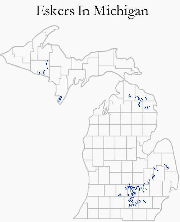
back and dumped its load of sediments in the channel. The most famous and
longest esker in Michigan is the Mason Esker, which runs from Dewitt
through Holt and Lansing, and ends at Mason. Most of the Mason esker has
been removed, its sand and sorted gravel used to make concrete highway
construction.
Most eskers are on till plains
although some are known to cut through moraines and even cross drumlins.
They vary in length from a fraction of a mile to scores of miles, and in
height from a few feet up to several hundred and more feet. More than a
thousand eskers have been found in Michigan.
Just as rivers on land carry and deposit sediment, meltwater that flows
in the openings beneath, above and within a glacier also carries and
deposits sediment. Tunnels near the base of retreating glaciers fill with
transported sediments, which remain as
sandy or gravelly ridges that
look like upside-down stream beds after the glacier melts away. The ice
that formed the sides and roof of the tunnel subsequently disappears,
leaving behind sand and gravel deposits in ridges with long and sinuous
shapes.
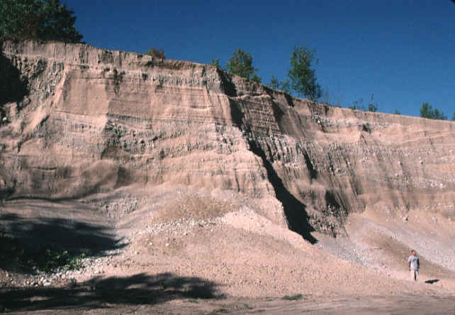
The shape of an esker (in cross-section) is shown in the
cut below.
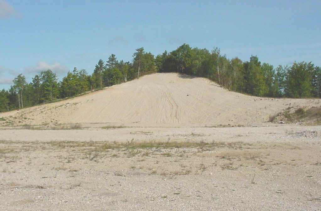
The image below shows
the stratified sand and gravel within the Osmun Lake esker, in Presque
Isle County, Michigan.
Eskers can be 500
to 600 kilometers long and, depending on the pattern of the glacier's
inner tunnels, can interconnect
in a pattern of central ridges and
tributaries, just like a branching river system. As you can see,
the esker is being mined as a source of aggregate.
Since eskers are made up of highly porous sand and gravel, they are
frequently excavated for construction. They are considered an endangered
geomorphological species since they have been used either to develop
roadways -- offering natural elevated, dry terrain -- or they have been
ripped up for the gravel to build nearby roads. For centuries in northern
Canada,
Inuit and wildlife have typically used eskers for high and dry
travel routes. More recently, eskers have been used in the hunt for
diamonds. Since they lie in the direction of glacial flow, prospectors
have used eskers to trace where minerals glacially eroded from
diamond-bearing formations have been transported. They trace these
"indicator" minerals "upstream" in an esker until they abruptly disappear:
this indicates the diamond source is
nearby.
This material has been compiled for educational use only, and may not be reproduced without permission. One copy may be printed for personal use. Please contact Randall Schaetzl (soils@msu.edu) for more information or permissions.