ENTISOLS
Entisols are weakly-developed soils. The lack of strong development in these soils is
often due to one of several factors: a persistent high water table (higher than in Inceptisols but not so high as in Histosols),
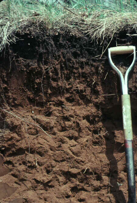
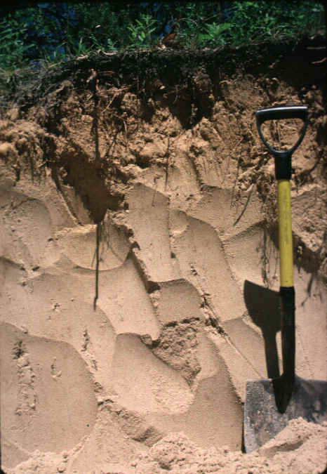
a parent material composed mainly of quartz sand (as in the soil below, a sandy Entisol
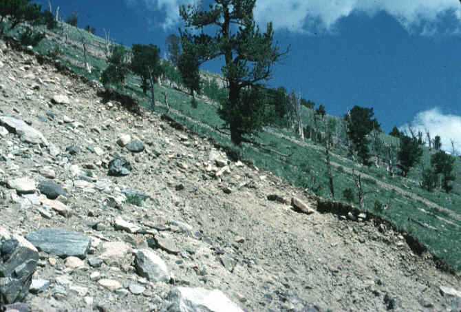
with only an A horizon over a C horizon), a location on an eroding slope (below...a scene
showing Entisols on a slope in Wyoming) or on a very young landscape, or are extremely
young because they have been recently disturbed by human activity.
Entisols are soils with little or no evidence of B horizon development and are found in
three areas in the southern part of the Lower Peninsula. They are alluvial, or
water-deposited, soils associated with the beds of glacial streams or with the sands and
gravels of glacial outwash. They tend to be low in humus and dry out quickly because of
the high sand or gravel content and are of limited importance in Michigan.
Obviously, sandy Entisols (on uplands) can be droughty soils.
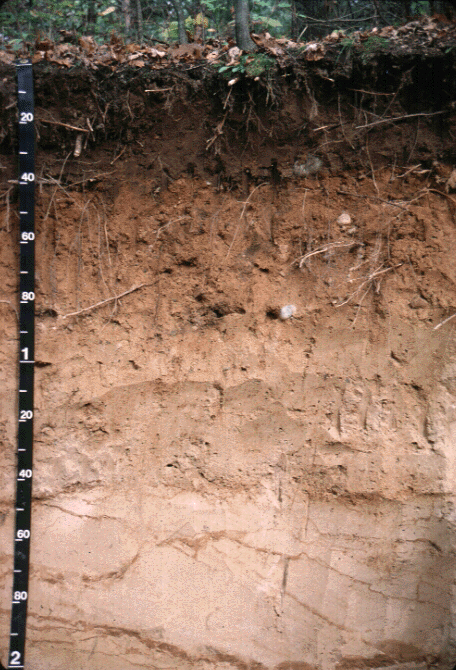
However, many of them have small amounts of clay, which infiltrating water reorganizes
into thin clay bands called lamellae. The sandy Entisol below shows such lamellae
(red bands below 140 cm). These clay bands can really "make the
difference" between a highly droughty soil and one that is capable of supporting a
dense and productive forest.
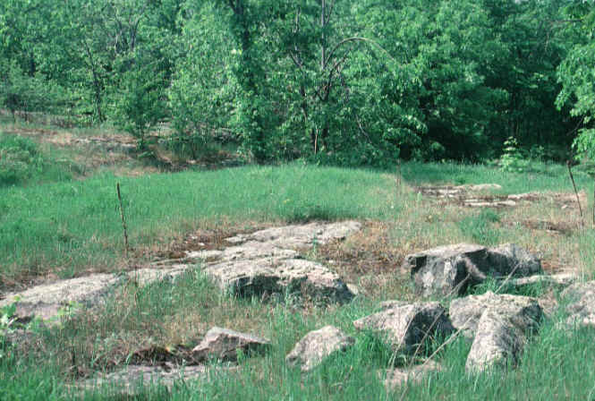
Entisols are common in the western UP, where glaciers have scraped much of the landscape
clean. The thin, patchy glacial drift overlying hard bedrock restricts soil
development, and the soils stay "entic".
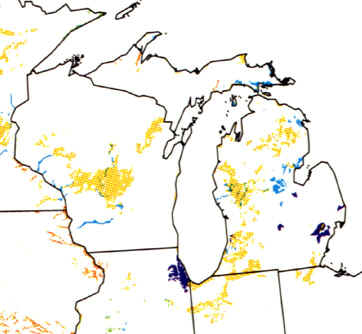
The map below shows that, in the Great Lakes region, Entisols are commonplace. The
Psamments, or dry, sandy Entisols, are most common, given the large amounts of sand in the
region. Arents (purple on the map) are disturbed soils in urban areas like Chicago
and Detroit. Some areas of the Saginaw Lake Plain
contain wet sands (Aquents).
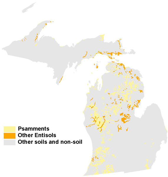
A more detailed map of the sandy Entisols can actually function as a map of sandy
sediments in Michigan. The sandiest moraines, outwash plains, and dunes show up
nicely on such a map (below) as Psamments (also the image below).
The orange areas are the young soils of river valleys, on shallow bedrock, and on the
wettest sites of the lake plain.
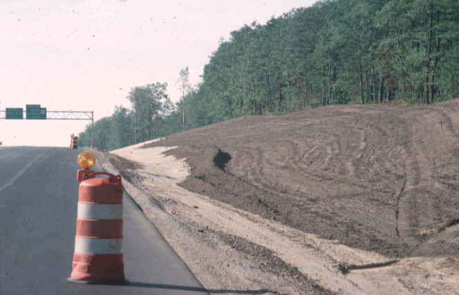
Most soils that have been "created" by humans are considered Entisols.
Thus, the soils that is being "made" along this freeway bank would be
man-made, yet classified as an Entisol. Note how the construction crews have spread
a thin layer of topsoil over the top of a scalped, sandy landform, with its C horizon of
sand showing.
Parts of the text on this page have been modified from L.M. Sommers' book entitled, "Michigan: A Geography".
This material has been compiled for educational use only, and may not be reproduced without permission. One copy may be printed for personal use. Please contact Randall Schaetzl (soils@msu.edu) for more information or permissions.