DRUMLINS
There are several large drumlin fields in the Great Lakes region. The map below
shows where they are; note that some are in Michigan.
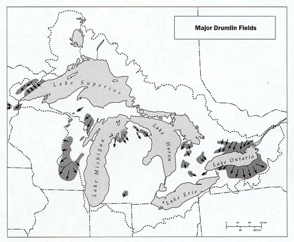
On the till plains in Branch, Kalamazoo, Antrim, Charlevoix, Menominee, and Iron counties, and on the plains of Cheboygan, Presque Isle, and Alpena counties, are curious long cigar-shaped hills known as drumlins. Drumlins occur in areas where the ice advanced over previously formed till plains. They are elongate in the direction of ice movement and most of them have a front or "stoss" slope at the head end which is somewhat steeper than the lee slope. The drumlins near Ellsworth, Antrim County, have cores of Ellsworth shale, those in Les Chaneaux Islands have cores of limestone. The roller coaster character of the old roads in Menominee County was caused by the roads crossing drumlins at right angles; the new highways cut through them, but the long narrow hills with graceful slopes are quite visible from the highways. As a rule drumlins are arranged more or less parallel, and are separated from each other by poorly drained troughs or swales. No completely satisfactory explanation has as yet been worked out to account fully for the origin of drumlins, but geologists have accepted the viewpoint that most drumlins were sculptured by active ice during an advance or readvance.
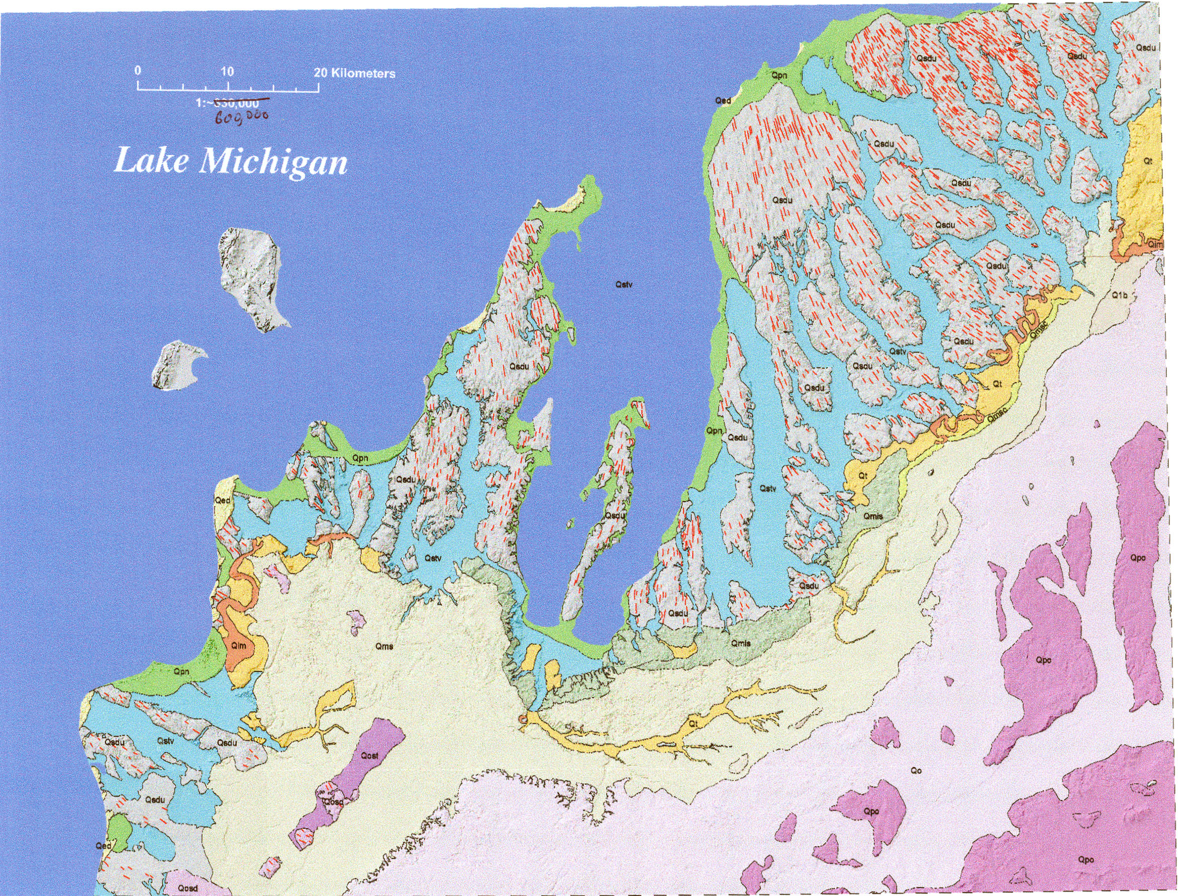
The Antrim-Charlevoix drumlin field
One of the largest and most widespread drumlin fields in the midwest
lies in the NW Lower peninsula, centered on Antrim and Charlevoix Counties.
The map below, from an unpublished paper by Lundstrom et al., shows the
drumlins as short, red, subparallel lines.
Note their spreading distribution - presumably formed as the ice was advancing
up and out of the deep Lake Michigan basin and radially spreading as it
did. The drumlin field is cut into many smaller pieces by deep (dry) valleys,
some of which contain long narow lakes such as Torch Lake and Lake Bellaire.
The Leelanau peninsula also contains a significant drumlin field, as does the Mission Peninsula.
This material has been compiled for educational use only, and may not be reproduced without permission. One copy may be printed for personal use. Please contact Randall Schaetzl (soils@msu.edu) for more information or permissions.