AIR MASSES
When a large body of air remains over an area for several days or weeks, the body of
air may change its thermal and moisture properties according to the land or water under
it. The air exchanges heat with the land or water, either warming or cooling, until its
temperature closely matches that of the surface below it. The body of air also gains or
loses moisture depending on the temperature and moisture content of the surface. A body of
air that resembles the characteristics of the surface under it is called an air
mass.
Source: Unknown
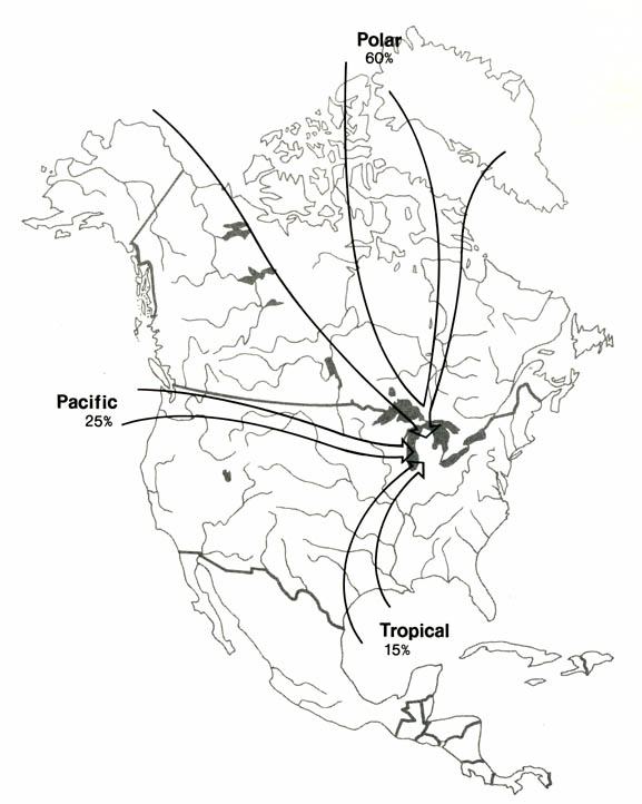
Five basic types of air masses affect Michigan's weather. They can bring anything from
scorching heat to bone-chilling cold depending on the type of air mass. The five are.
Continental Arctic (cA): Extremely cold temperatures and very
little moisture. These usually originate north of the Arctic Circle,
where days of 24 hour darkness allow the air to cool to sometimes record-breaking low
temperatures. Such air masses often plunge southward across Canada and the USA during
winter, but very rarely form during the summer because the sun warms the Arctic.
Continental polar (cP): Cold and dry, but not as cold as
Arctic air masses. These usually form farther to the south and often
dominate the weather picture across the USA during winter. Continental polar masses do
form during the summer, but usually
influence only the northern USA. These air masses are the ones responsible for bringing
clear and pleasant weather during the
summer to the North.
Maritime polar (mP): Cool and moist. They usually bring
cloudy, damp weather to the USA. Maritime polar air masses form over the northern Atlantic
and the northern Pacific oceans. They most often influence the Pacific Northwest and the
Northeast. Maritime polar air masses can form any time of the year and are usually not as
cold as continental polar air masses.
Maritime tropical (mT): Warm temperatures with copious
moisture. Maritime tropical air masses are most common across
the eastern USA and originate over the warm waters of the southern Atlantic Ocean and the
Gulf of Mexico. These air
masses can form year round, but they are most prevalent across the USA during summer.
Maritime tropical air masses are
responsible for the hot, humid days of summer across the South and the East.
Continental Tropical (cT): Hot and very dry. They usually
form over the Desert Southwest and northern Mexico during summer. They can bring record
heat to the Plains and the Mississippi Valley during summer, but they usually do not make
it to the East and the Southeast. As they move eastward, moisture evaporates into the air,
making the air mass more like a maritime tropical air mass. Continental tropical air
masses very rarely form during winter, but they usually keep the Desert Southwest
scorching above 100 degrees Fahrenheit during summer.
This material has been compiled for educational use only, and may not be reproduced without permission. One copy may be printed for personal use. Please contact Randall Schaetzl (soils@msu.edu) for more information or permissions.