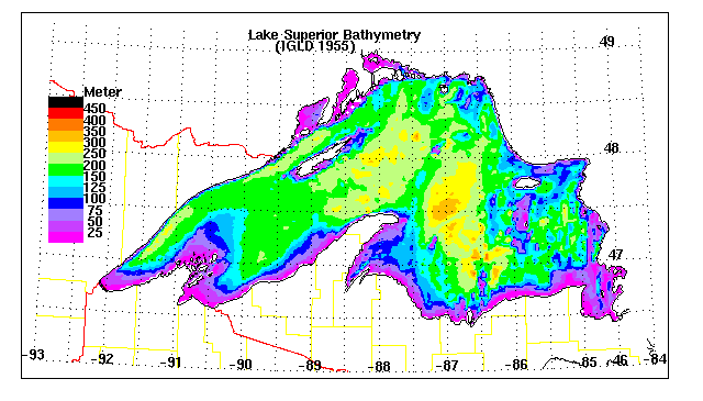
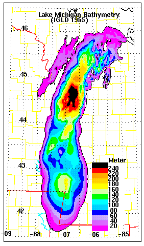
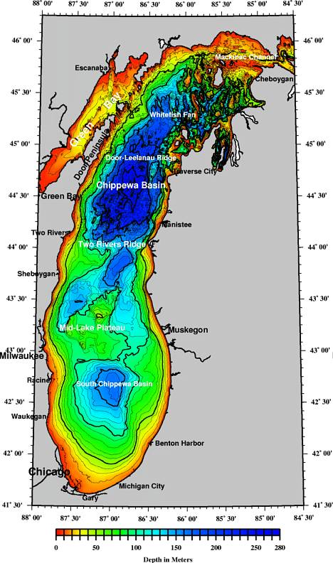
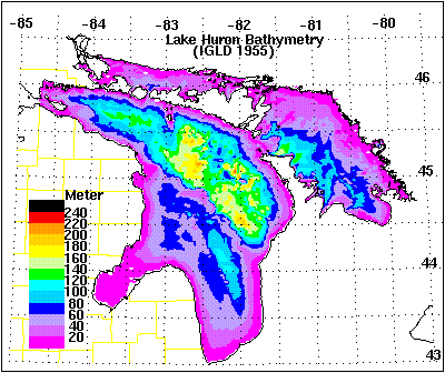
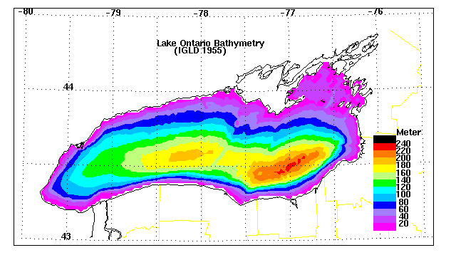
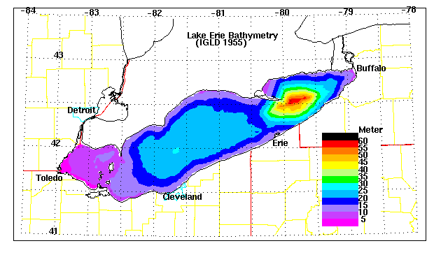
GREAT LAKES BATHYMETRY
The Great Lakes have been deeply scoured by repeated ice advances. They are deepest
where the underlying rocks are weakest, as for example where shale is the bedrock (see the
deepest parts of Lake Michigan?!). Resistant rocks, like the Portage Lake lavas of the
western UP, stand up as ridges and islands (Isle Royale and the Keweenaw Peninsula).
Similarly, the hard Niagara Dolomite forms several islands and peninsulas in the lakes
proper.
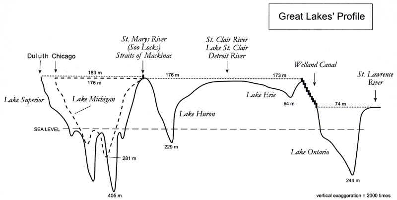
The five bathymetric maps (maps of the lake bottom configurations) below provide more
detail on the bottom configurations of the Great Lakes. See if you can explain the
origins of some of the "bumps and hollows" found there, based on your knowledge
of the rocks and glacial features of the Great Lakes region.
This material has been compiled for educational use only, and may not be reproduced without permission. One copy may be printed for personal use. Please contact Randall Schaetzl (soils@msu.edu) for more information or permissions.