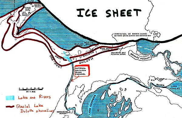
This paleochannel was a major drainageway for Glacial lakes in the Superior basin, when the ice sheet was still blocking the St. Mary's River at Sault Ste. Marie.
Today it remains as a deep channel through the UP, essentially dividing the UP into two parts.
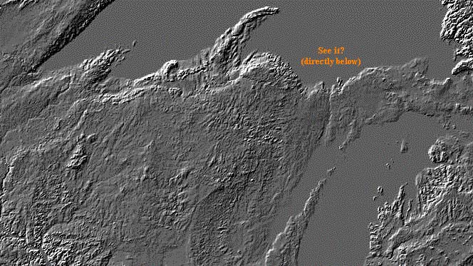
This is how the channel looks on a digital elevation model:
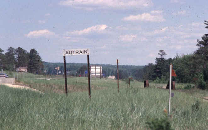
If you drive by on M-28, you can't miss the channel, or the sign:
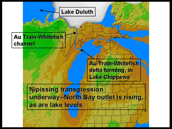
The Au Train Whitefish channel emptied into Lake Michigan. At that time, Lake Michigan was in a low stage, allowing the rivers in the Au Train Whitefish "river" to cut a deep channel in the basin of Lake Michigan. Farther downstream, the river did empty into (a lower stage of) Lake Michigan and build a delta (Whitefish fan). All of these features can be seen in the image below.
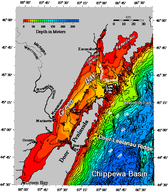
Navigation charts have, since the 1920's, shown indistinctly the existence of the large submerged channel beginning in Little Bay de Noc and extending across the floor of Green Bay and around Washington Island. To this feature we give the name Whitefish Channel because of its association with the Whitefish River and the Au Train-Whitefish Valley on land. Geologists have been speculating for over a century about the history of the large valley extending northward from Little Bay de Noc across the upper peninsula to Au Train Bay on Lake Superior. These earlier interpretations presented difficulties because only higher, not lower, late glacial and postglacial lake levels were assumed. Once the likelihood of a postglacial lowstand in Lake Michigan was established, University of Illinois Professor Hough (1955) recognized that the Au Train-Whitefish Valley, together with the submerged channel extending across Green Bay, was probably the site of the main outlet of Lake Superior into Lake Michigan at a time when Lake Michigan level was low (from 10,000 to 5,000 years ago).
About 1968, Northern Michigan University Professor John Hughes obtained
the Lake Survey sounding sheets from the immediate area of the Whitefish
Channel and described the lake bottom morphology. He discovered the
existence of the large fan, here named the Whitefish Fan, which lies at
the downslope end of the Whitefish Channel and has a top depth in the
range of 50 to 55m. Hughes attributed formation of the Whitefish Channel
and Fan to drainage, possibly catastrophic at times, of Lake Superior into
Lake Michigan when western Lake Superior was open water but eastern Lake
Superior was filled with ice and the St. Marys River outlet was blocked.
The bathymetry data shown above give an integrated
view of the channel and fan and the topography of the surrounding lake
floor which is more detailed than that published by Hughes (1989). It
demonstrates that there are no other submerged fans or channels in
northern Lake Michigan of anywhere near comparable size.
This material has been compiled for educational use only, and may not be reproduced without permission. One copy may be printed for personal use. Please contact Randall Schaetzl (soils@msu.edu) for more information or permissions.