Existing data sets, including those from the JFSP-funded Smoke and Emissions Model Intercomparison Project (SEMIP) and the New Jersey Pine Barrens PM2.5 monitoring sites will be used to evaluate the models. In addition, on-site monitoring at prescribed burns in the New Jersey Pine Barrens (JFSP funded project to be carried out by the NRS) and at The Nature Conservancy’s North Carolina Calloway Forest/Sandhills Preserve (JFSP funded project to be carried out by the PNW Research Station) will also be used for model validation. The validation will focus on the models’ ability to predict smoke meandering, entrainment, re-circulation, transport and dispersion within and above forest canopy in both daytime and nighttime conditions. Time series and statistical analyses of meteorological quantities and PM2.5 concentrations at monitoring sites will be used to quantify errors and uncertainties in simulating smoke trajectories and surface concentrations. Specifically, we will address the impact of surface winds, boundary-layer turbulence, mixed-layer depth, mixed-layer-average winds, static stability, and other relevant meteorological quantities on smoke dispersion within and above the forest canopy.

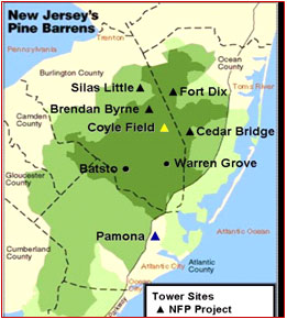
The experimental site for the monitoring component of this study is located in the New Jersey Pine Barrens Administrative Area and National Reserve. The Pine Barrens have some of the most volatile fire cycle vegetation in the East (Pitch Pine, scrub oaks and shrubs). Smoke emissions and air quality are major concerns here.

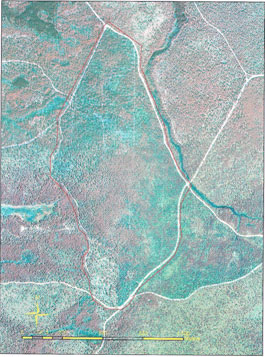
Proposed burn site, 265 acres Pitch Pine overstory ~30' -40' coordinates 39 52 25.13 N, 74 30 04.33 W.

